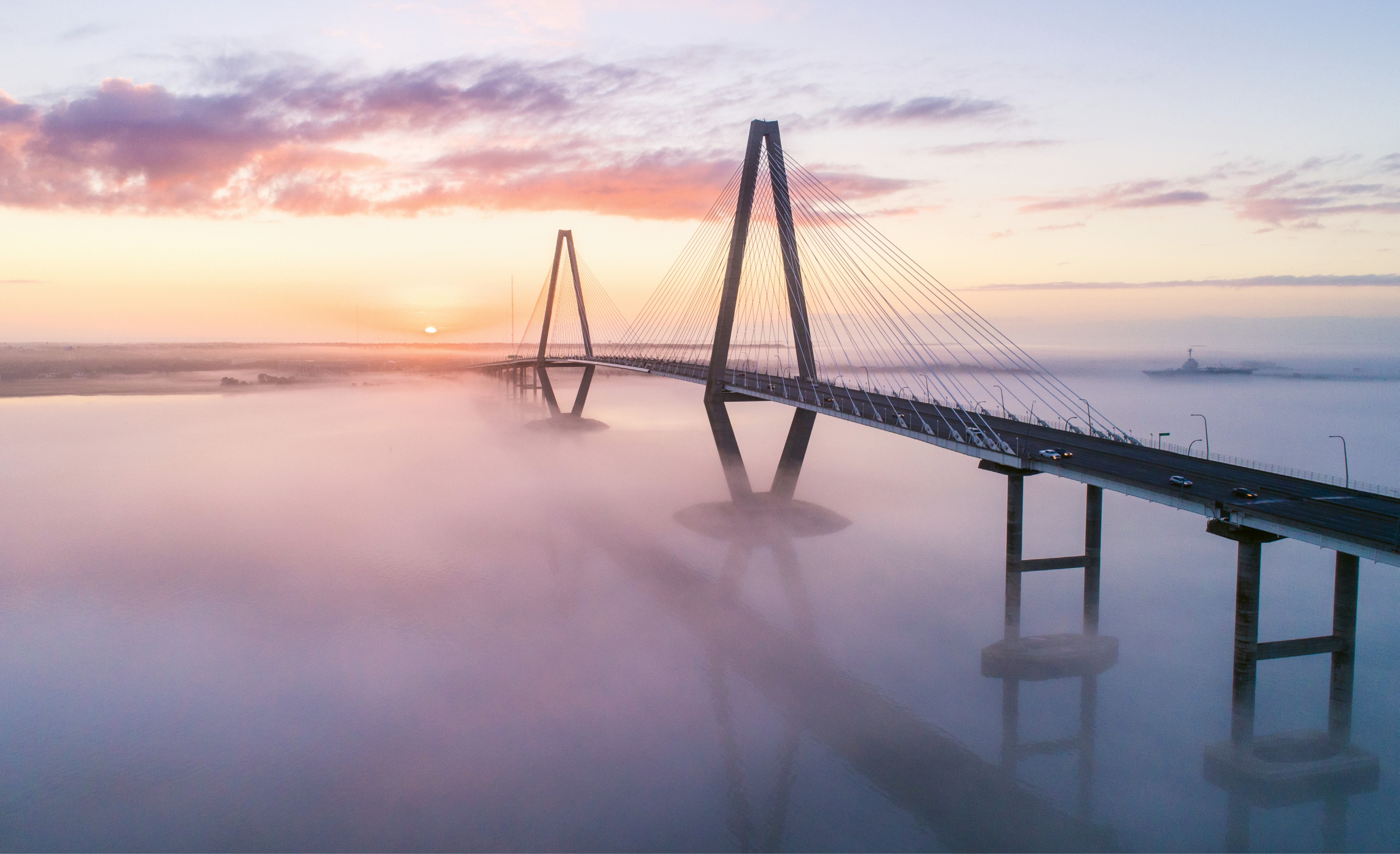
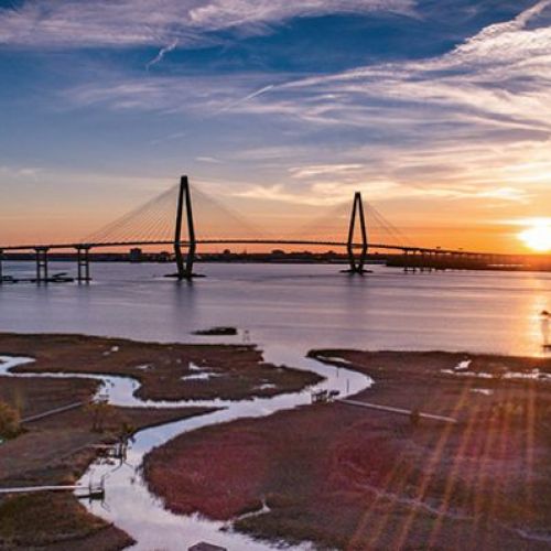
“Sea Fog at Sunrise” {Altitude: 255 feet} In late February, a blanket of fog hovers below the Arthur Ravenel Bridge, reflecting the sunrise.
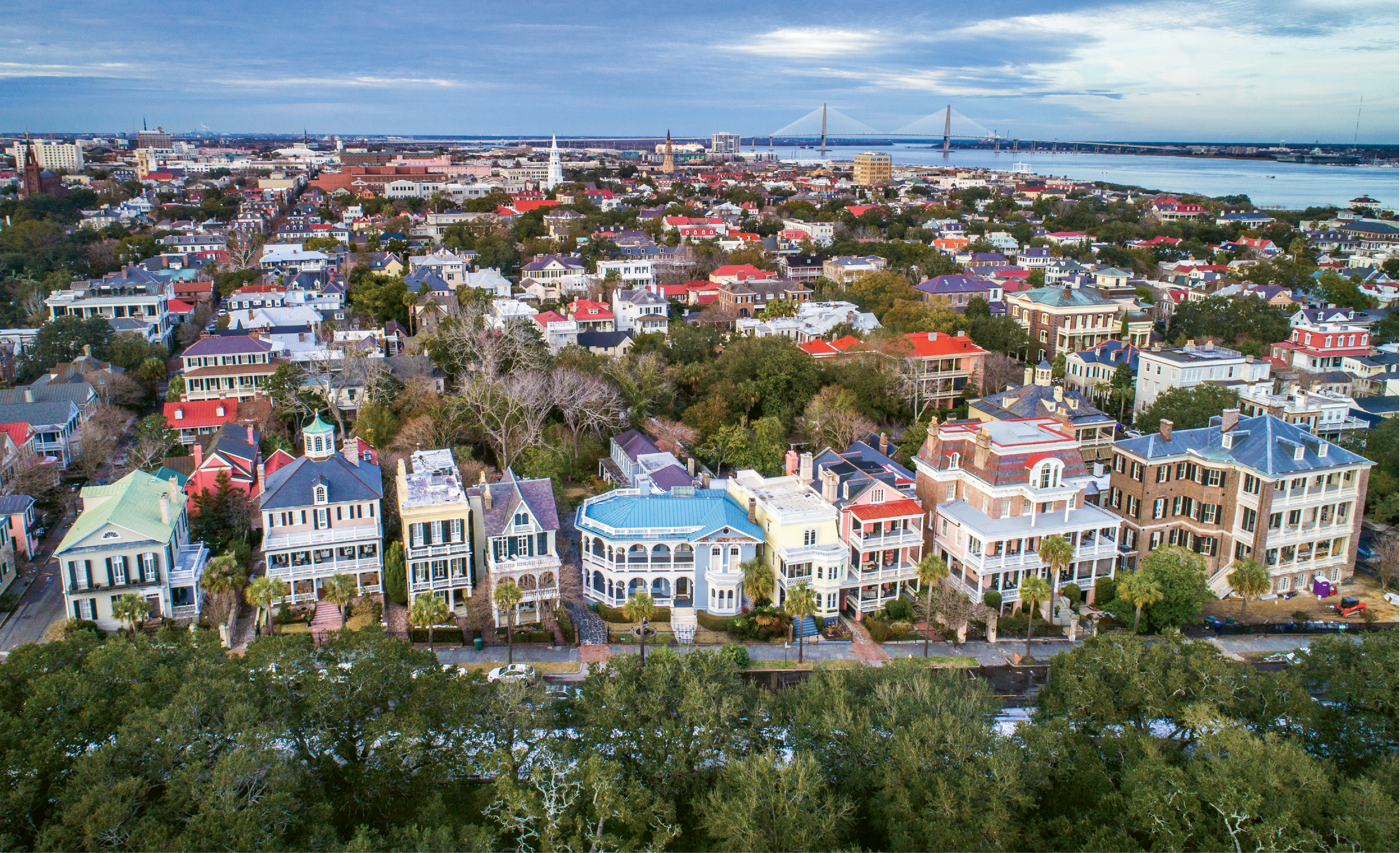
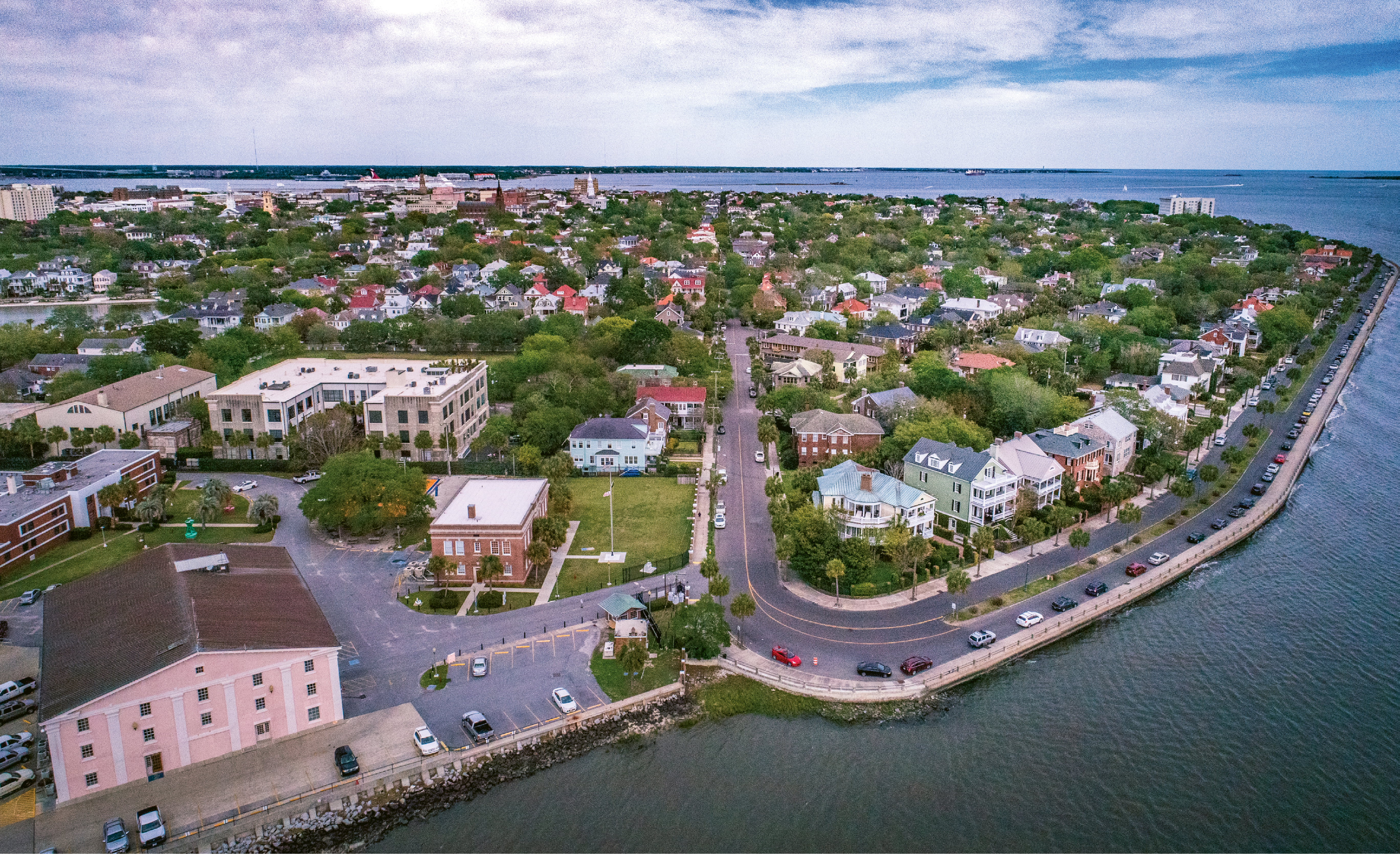
“South Battery & King” {Altitude: 120 feet} Flying above the oaks in White Point Garden offers a new vantage point to take in the historical homes on South Battery, with the Holy City skyline and Charleston Harbor in the background.
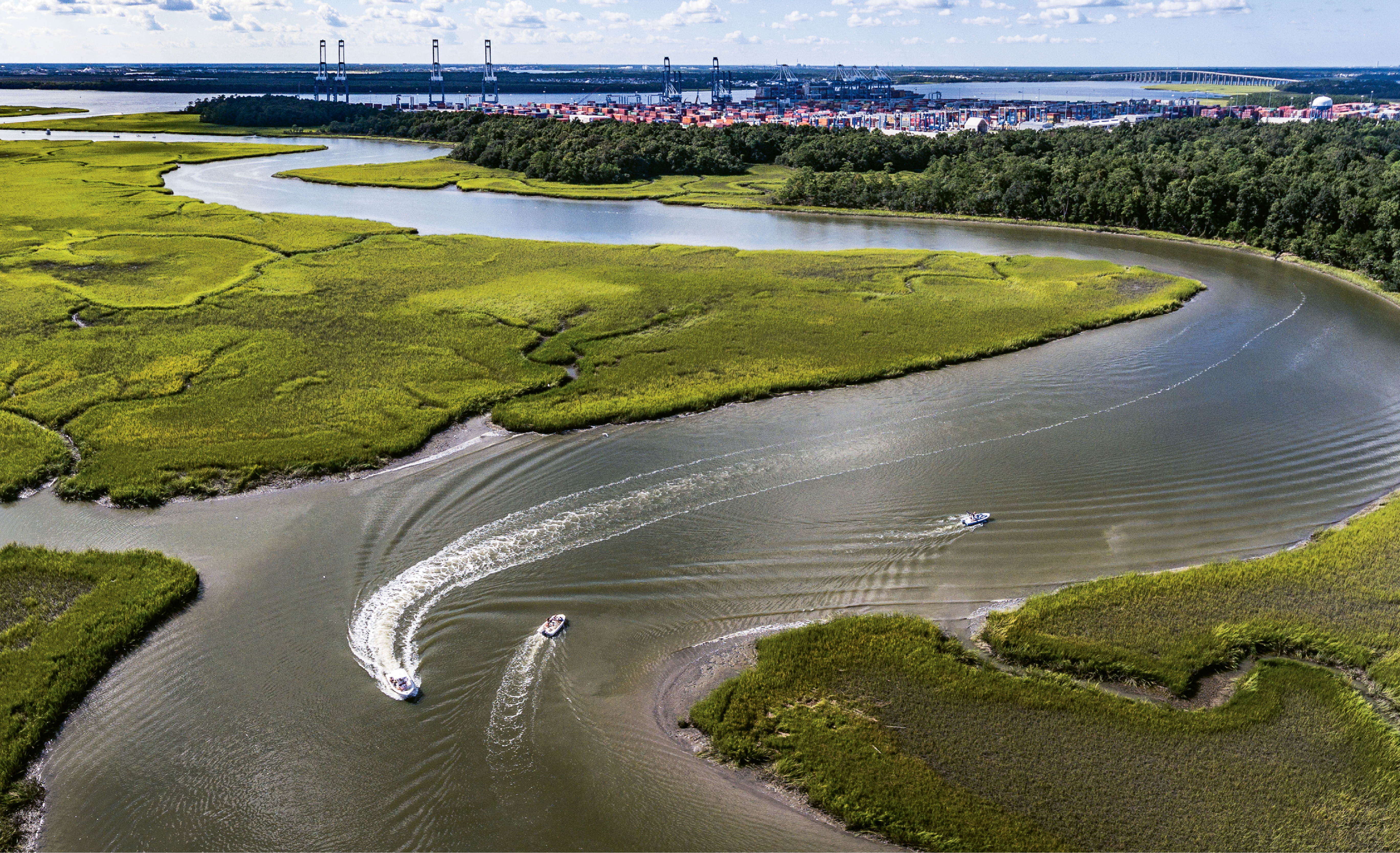
“Cooling Off on Hobcaw” {Altitude: 115 feet} Pleasure boats cruise Mount Pleasant’s Hobcaw Creek while the port’s Wando Welch Terminal hosts a big ship during the dog days of summer.
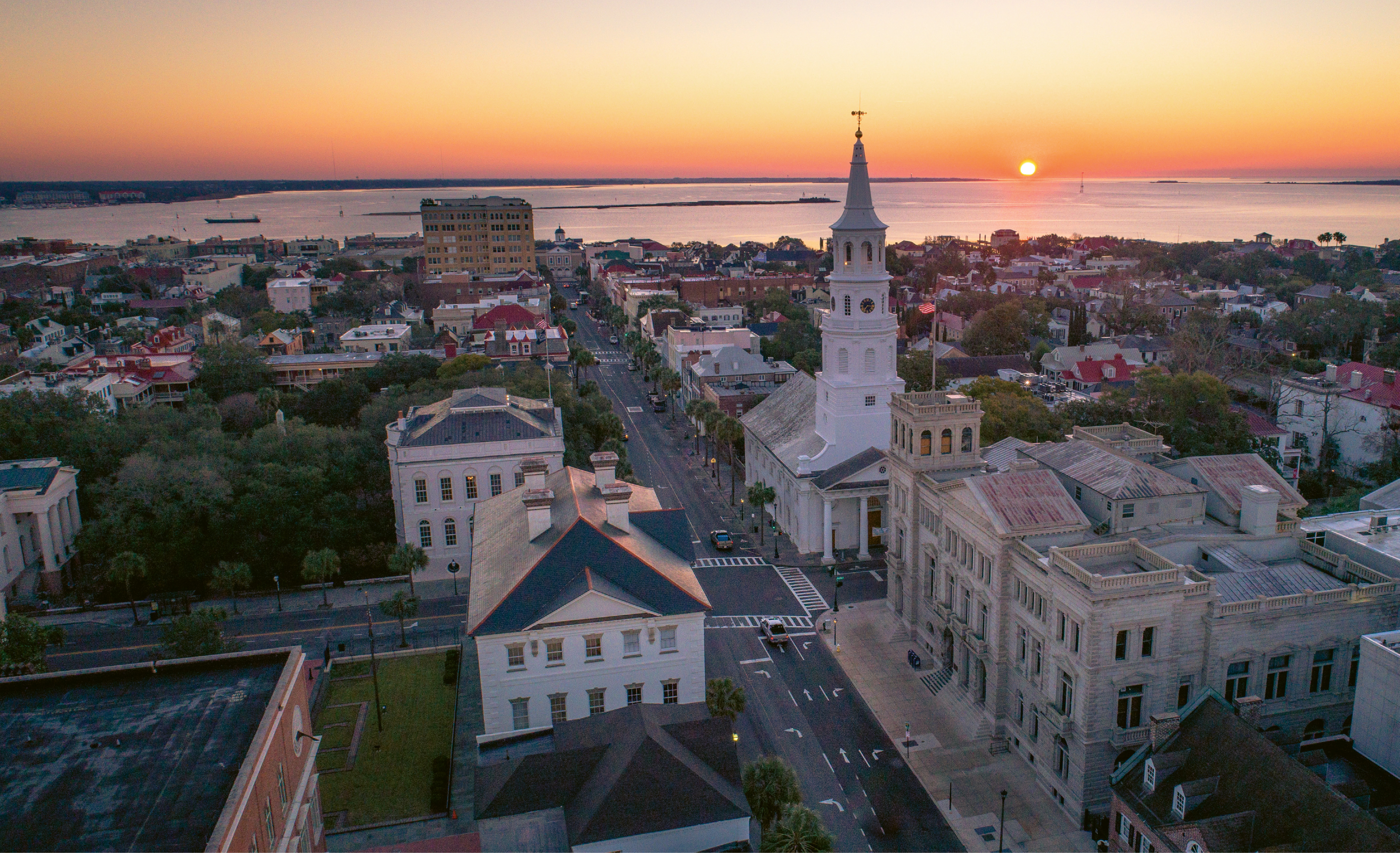
“Broad Street Sunrise” {Altitude: 120 feet} Sunrise over the Four Corners of Law, February 2018
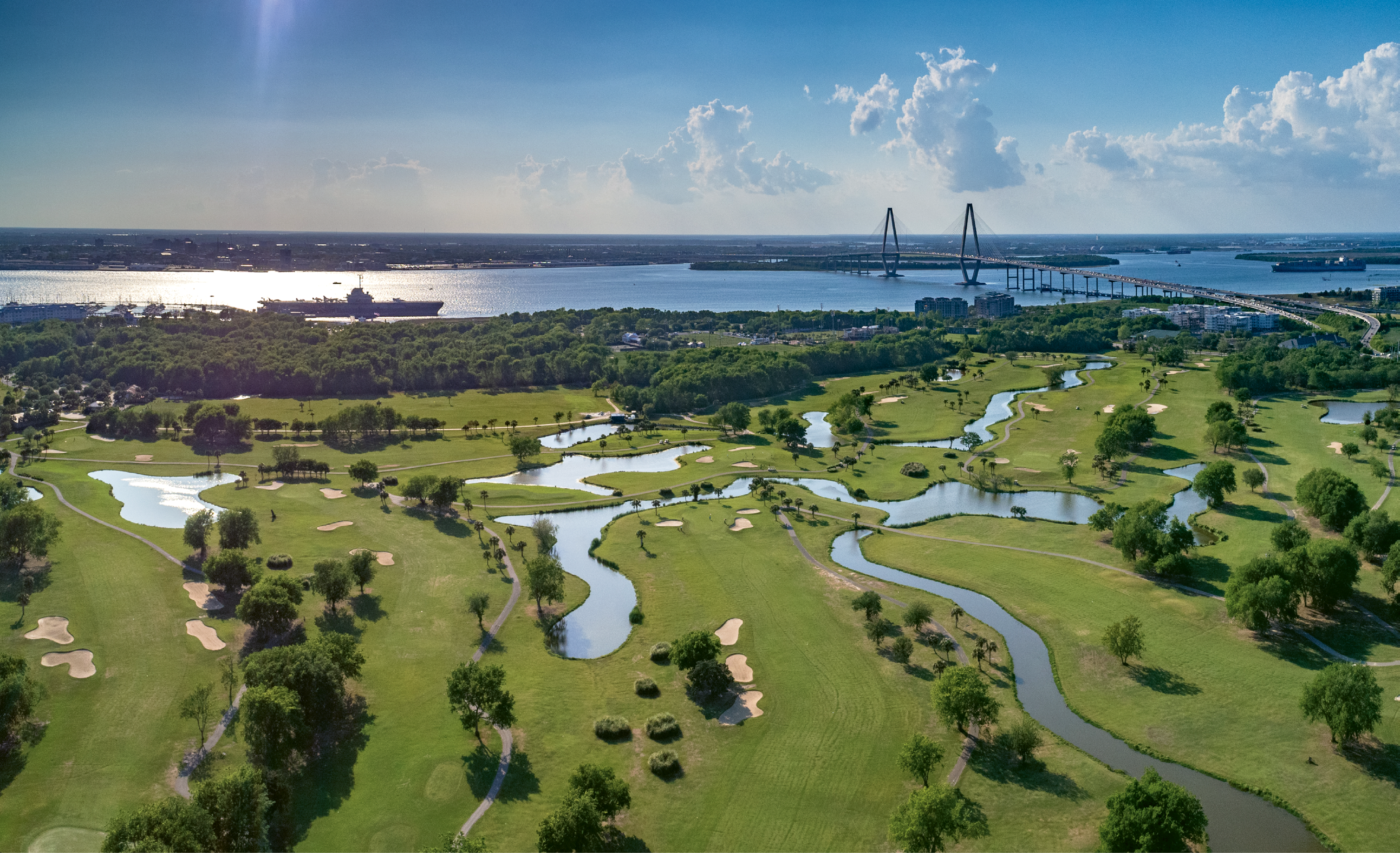
“Patriots Point Links” {Altitude: 200 feet} High above Mount Pleasant’s harborside golf course one April afternoon, with views of the USS Yorktown and downtown beyond
“The Battery Bend” {Altitude: 120 feet} A new take on the peninsula’s distinct shape from the western edge at Tradd Street and Murray Boulevard
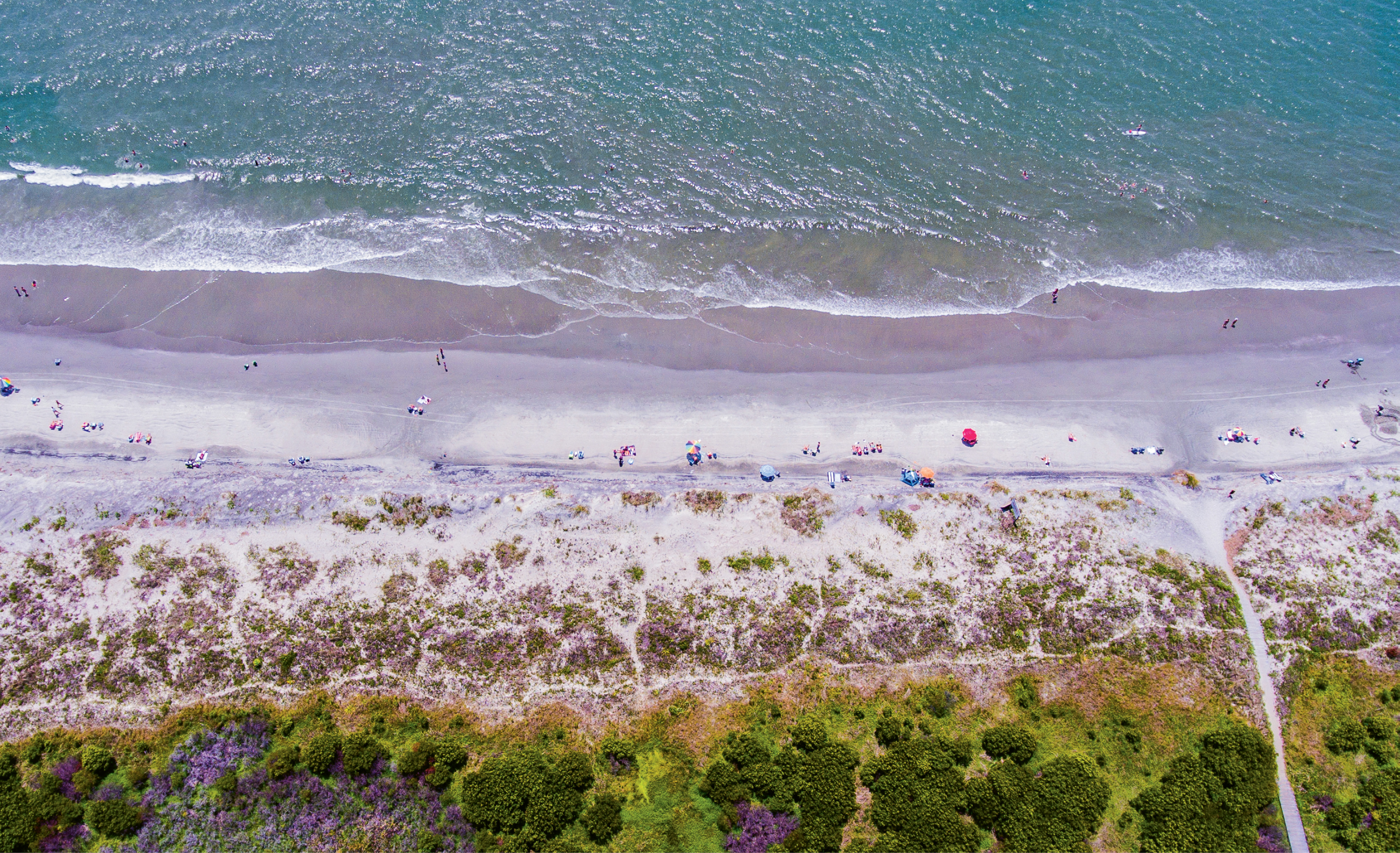
“Beach Day on Sully’s” {Altitude: 350 feet} Midday in early June near Station 25 on Sullivan’s Island
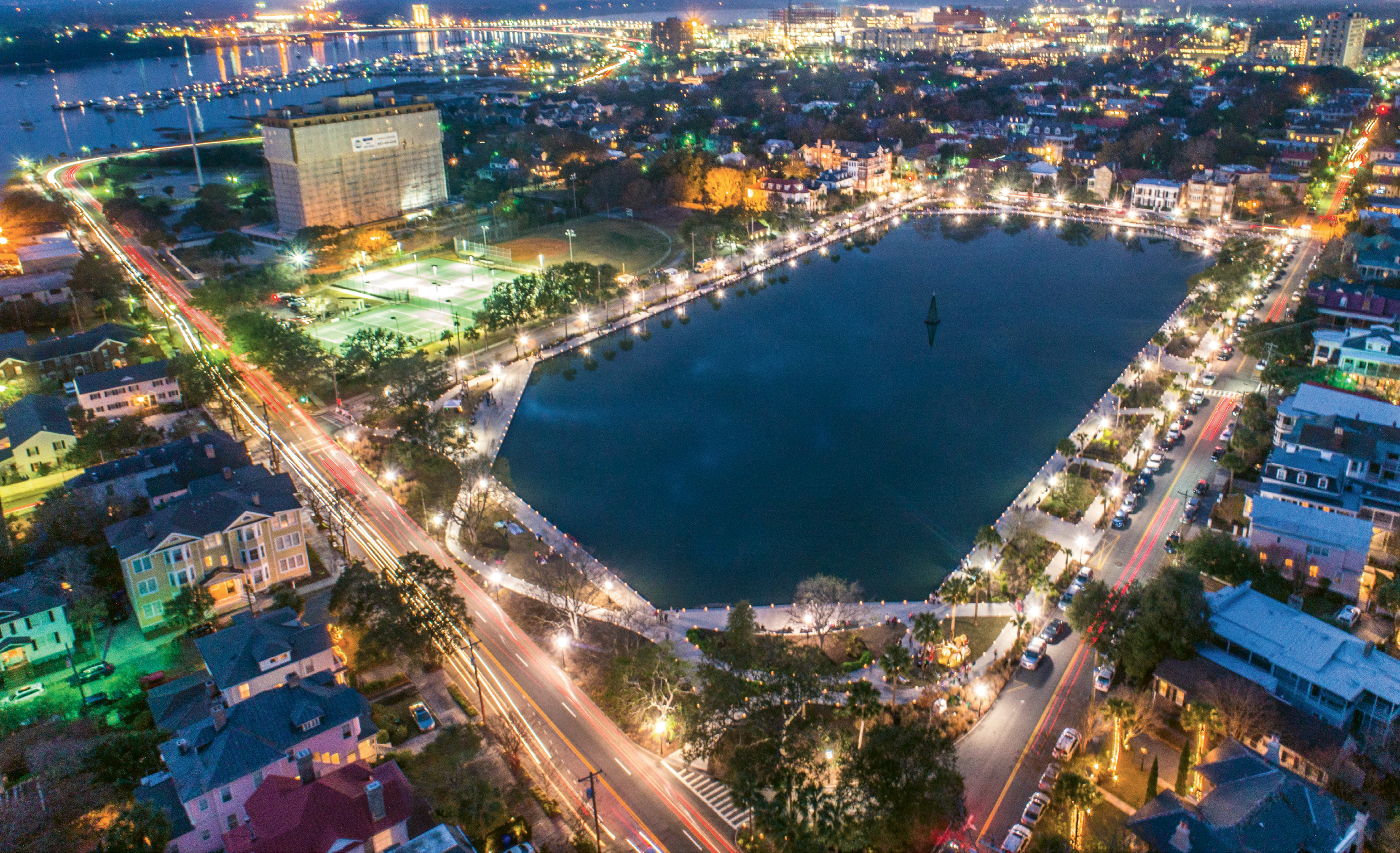
“Rush Hour on Colonial Lake” {Altitude: 140 feet} A long exposure taken on a busy holiday evening prior to the “Light the Lake” Christmas tree festivities last December
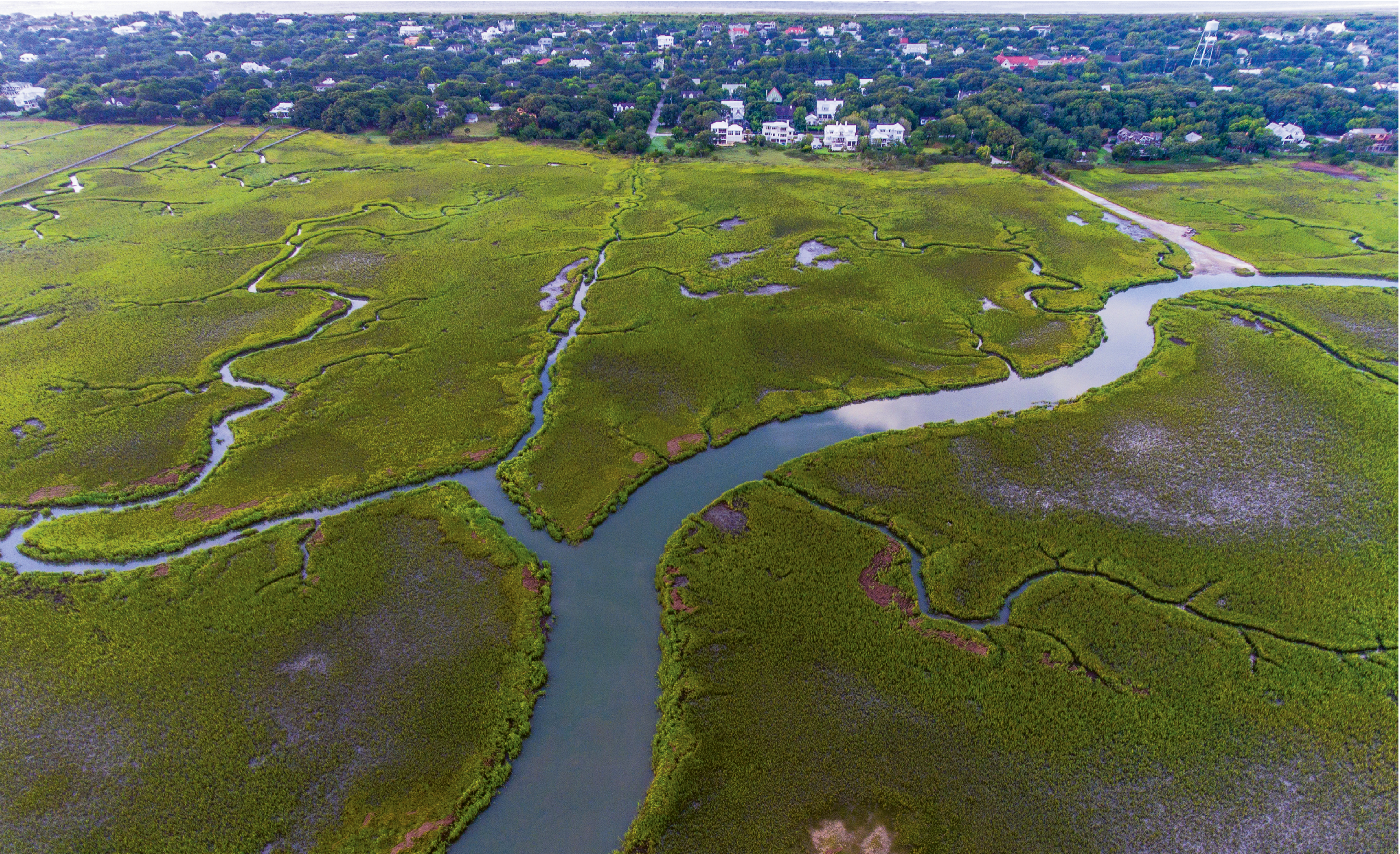
“Summer Creeks” {Altitude: 250 feet} Intracoastal marsh creeks near Station 26 1/2 on Sullivan’s Island
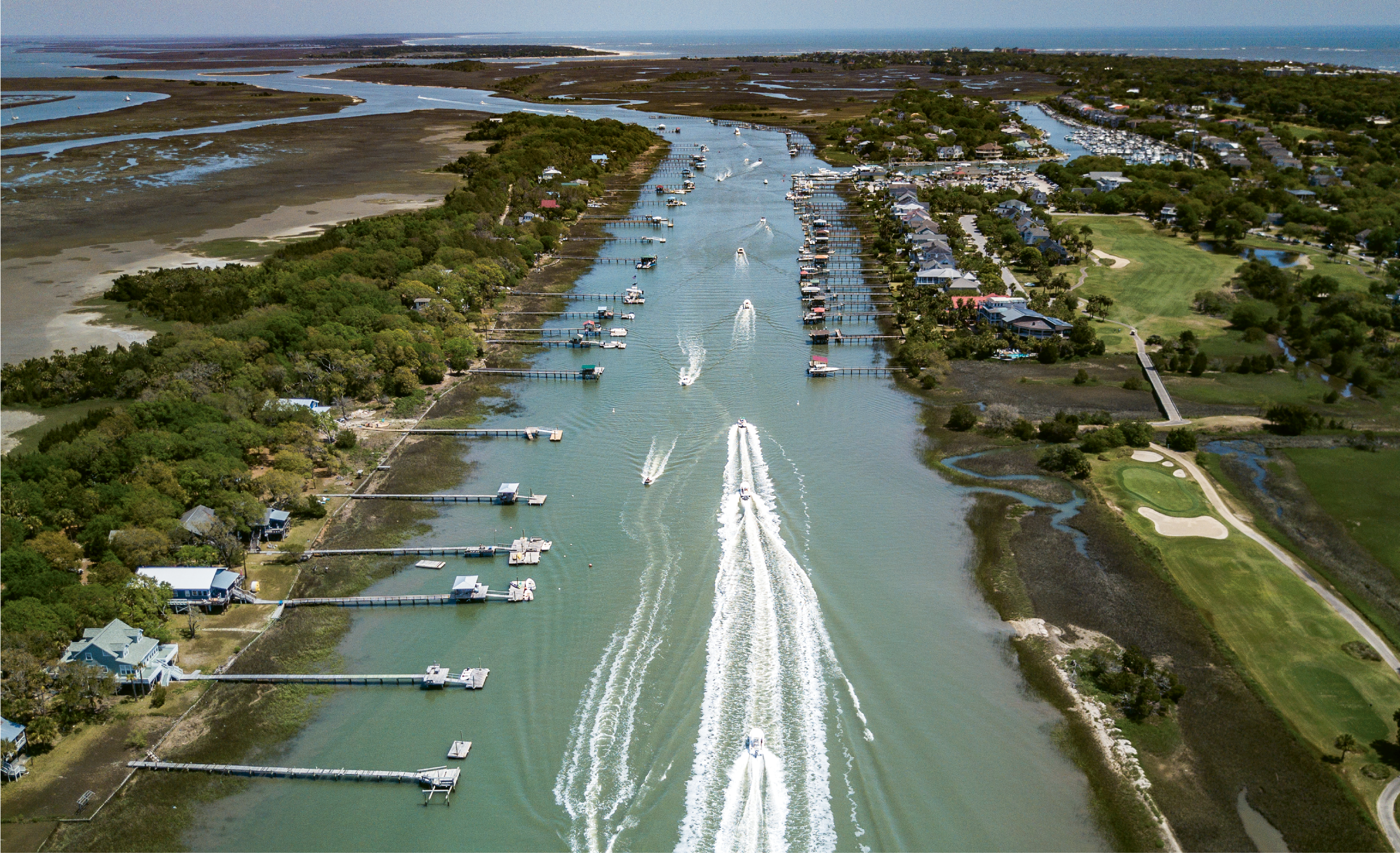
“Easter Weekend Traffic” {Altitude: 250 feet} A parade of boats motoring down the Intracoastal Waterway near Isle of Palms
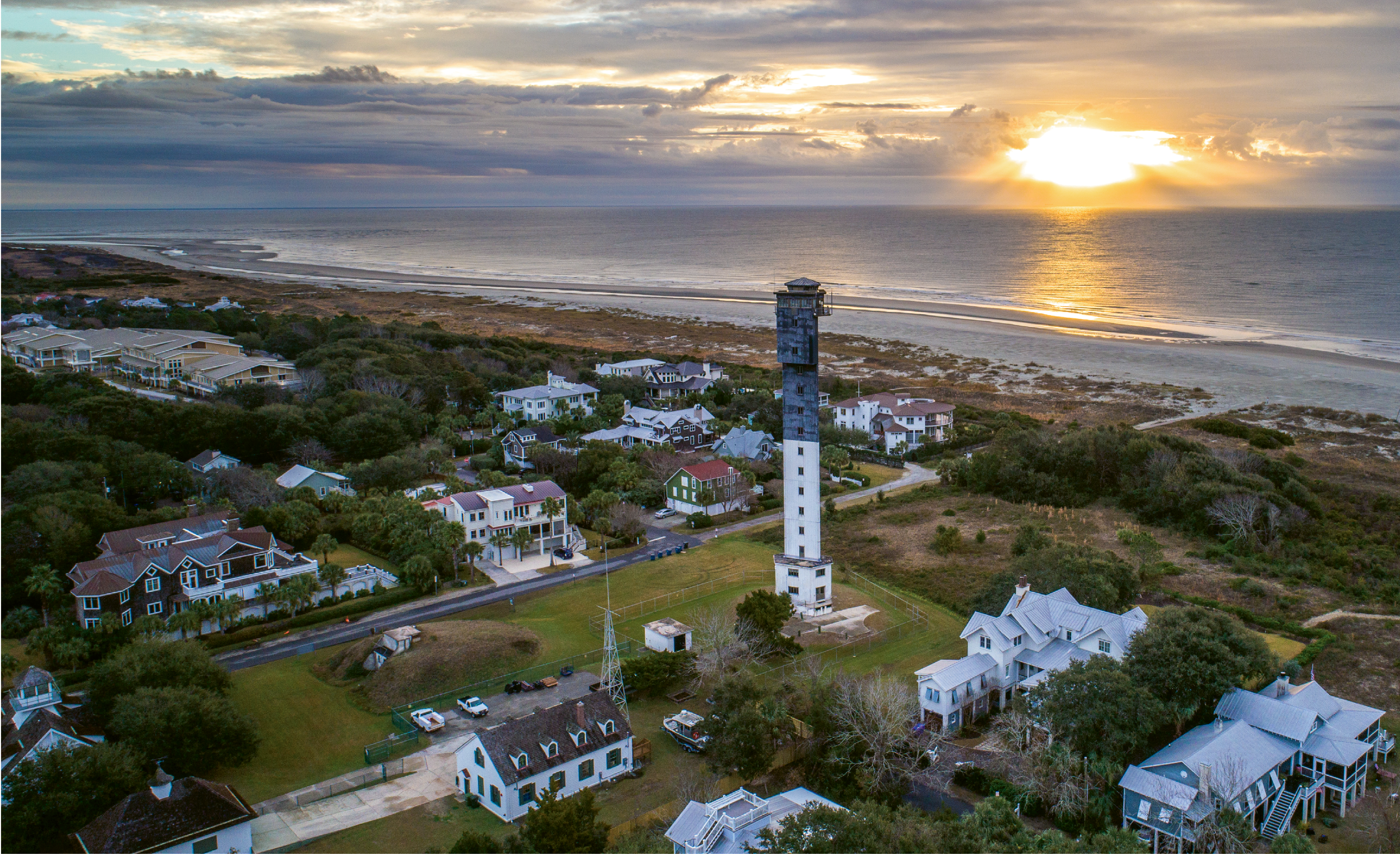
“Charleston Light, Winter Sunrise” {Altitude: 190 feet} The Sullivan’s Island lighthouse amidst a chilly December sunrise
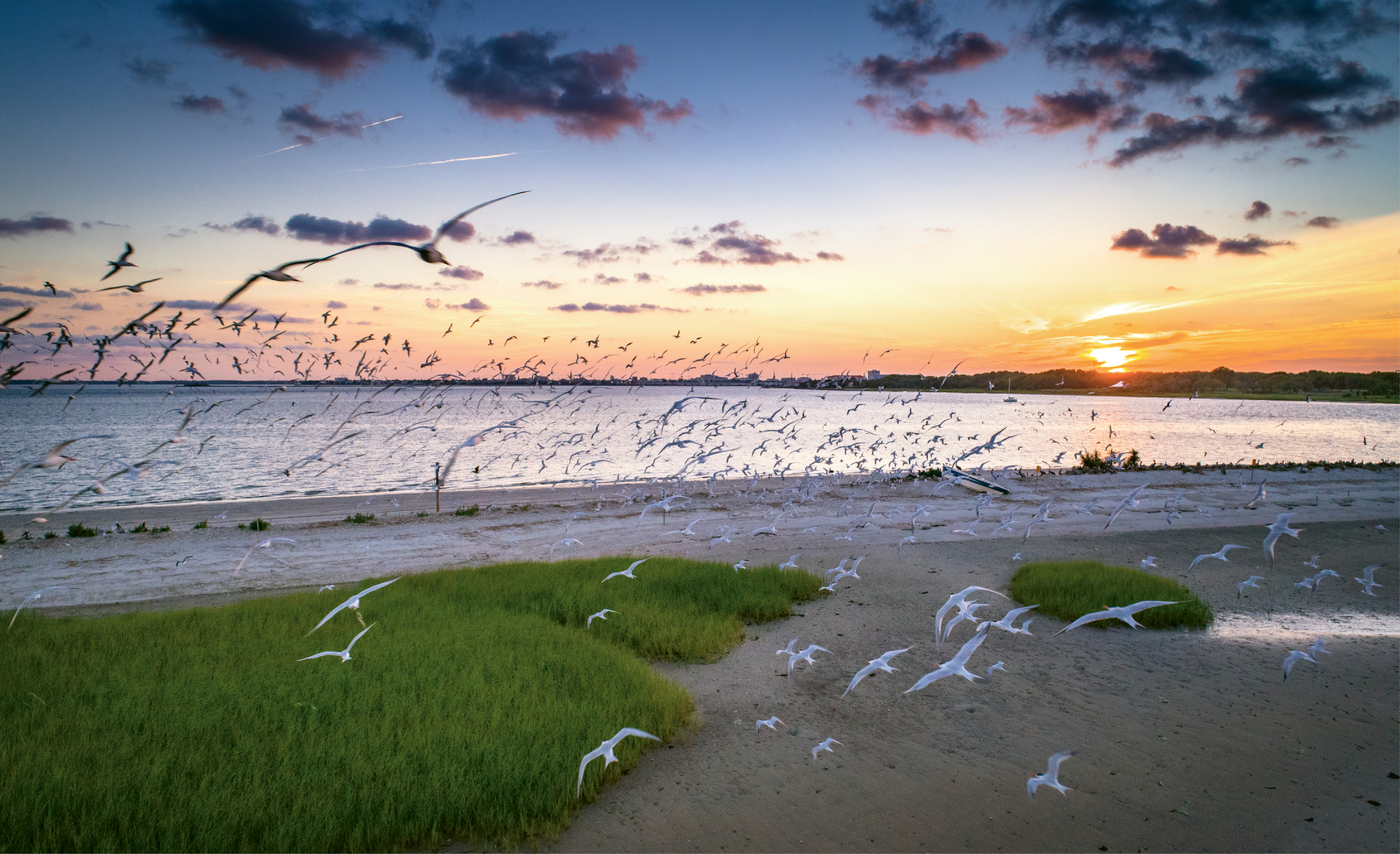
“Flying Colors” {Altitude: 45 feet} A wreck of seabirds takes flight off Shutes Folly.